
The Copper Canyon had provided its fair share of ups and downs.
Both literally and figuratively.
This graph plotting the altitude recorded by our GPS tells the story best.
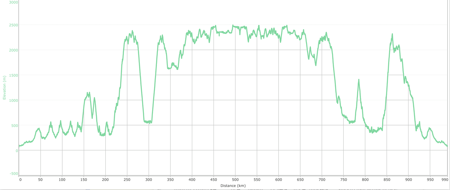
The lowest points on the drive were close to sea level, with the roads reaching the altitude of 2500m above sea level (8200 feet). Combined with all the ups and downs in the middle it is a fairly accurate representation of our travels. From the frustrations of driving at night, to the spectacular view from the canyon rim, the disappointment of waking up in a carefully chosen camp spot to a mist-obscured view, to the exhilaration of zipping over the gaping chasm of the canyon below.
Another variation that accompanied the changes in altitude was a transition between two different climates. On the canyon rim pine and oak forests, chilly winter air, mist, cloud and even snow and ice were the norm. A descent to the canyon floor was greeted by a warm, humid, sub-tropical climate. One road would transition from rocky alpine pine forests through sparse areas of desert cactus, then lower to the lush sub-tropical foliage of the canyon floor. Here, the scenery was dominated by lush green palms and huge ficus trees with their woven tapestry of roots flowing like liquid over the surfaces they grasped.

It was time to head back to the warmth of the canyon floor. Before leaving the alpine reaches of the canyon, we dropped in to the tourist office in Creel and picked up a tourist map with the road to Batopilas marked on it.
Finally, a map.
It turned out that we didn’t actually need this map. The roads between Creel and Batopilas were clearly sign-posted and paved almost all the way.

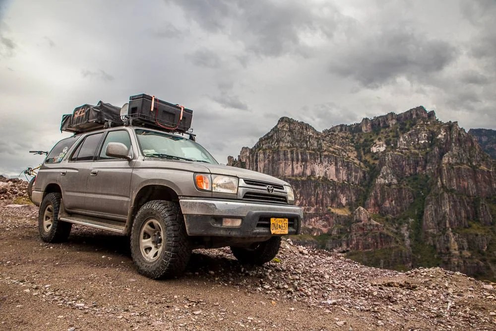
The roads may have been clearly sign-posted and paved, but that didn’t mean that the scenery was any less spectacular.

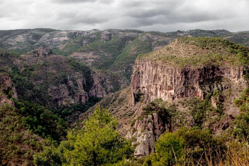


However, despite the fact that the workers were still building the road, the Sierra Madre mountain range was clearly winning the fight against some of the newly paved sections of road. Large landslides meant that many kilometres of this brand new divided highway were reduced to a single lane.
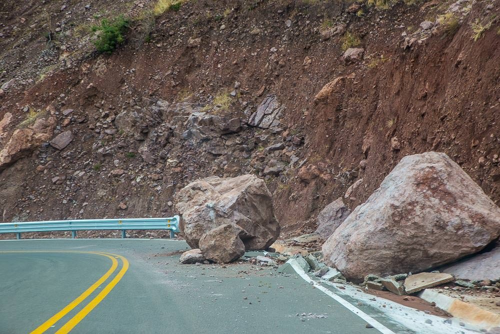


Driving down the road, you would come across a scene like this:
With the only defence being a flimsily constructed wall like this:

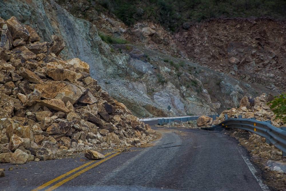
Usually these walls appeared to either be in entirely the wrong place, just to one side of a rockfall. Perhaps the ones in the right place had just been entirely engulfed by rockfall, all traces of them obliterated by the crumbling faces of the mountains above.
It seemed like the road workers had their jobs cut out taming Mexico’s wild Copper Canyon region. Even more so, when you saw the machinery that had been knocked out of commission by the rock falls.


But we weren’t there to tame the canyon, we were there to explore it.
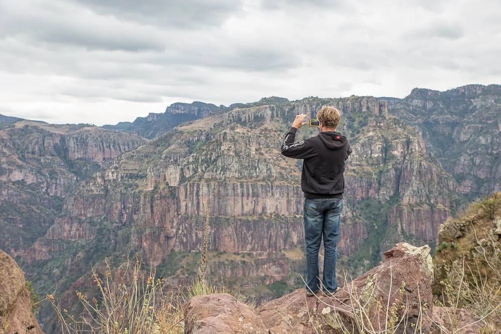
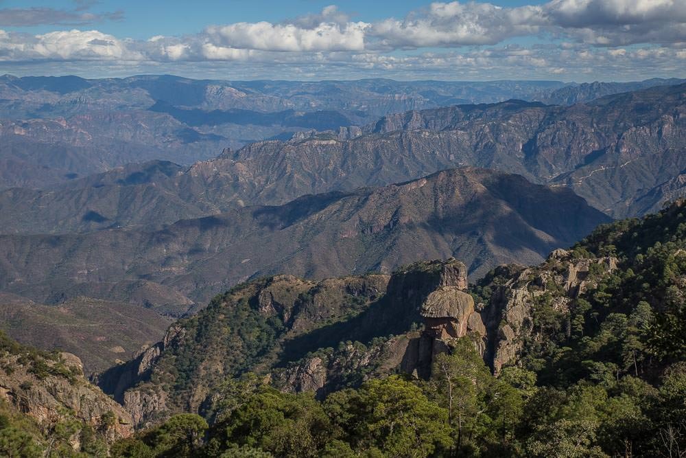
As we wove our way around the various rock slides we continued to catch glimpses of the dramatic views. The serpentine road descending from the canyon rim to the town of Batopilas, nestled by the river in the canyon’s floor couldn’t help but grab our attention. It was no less spectacular than the road that connected the town of Urique to the upper reaches of the canyon that we had explored earlier that week. Sure, the paved road made it feel a little less adventurous, a little safer, but the grandeur of the landscape still dwarfed our tiny home on wheels into insignificance.

The canyon below served as a constant reminder of the sheer enormity of the adventure we were undertaking. If a canyon like this is just a small part of the journey you are on, then you know you’ve probably over-committed.

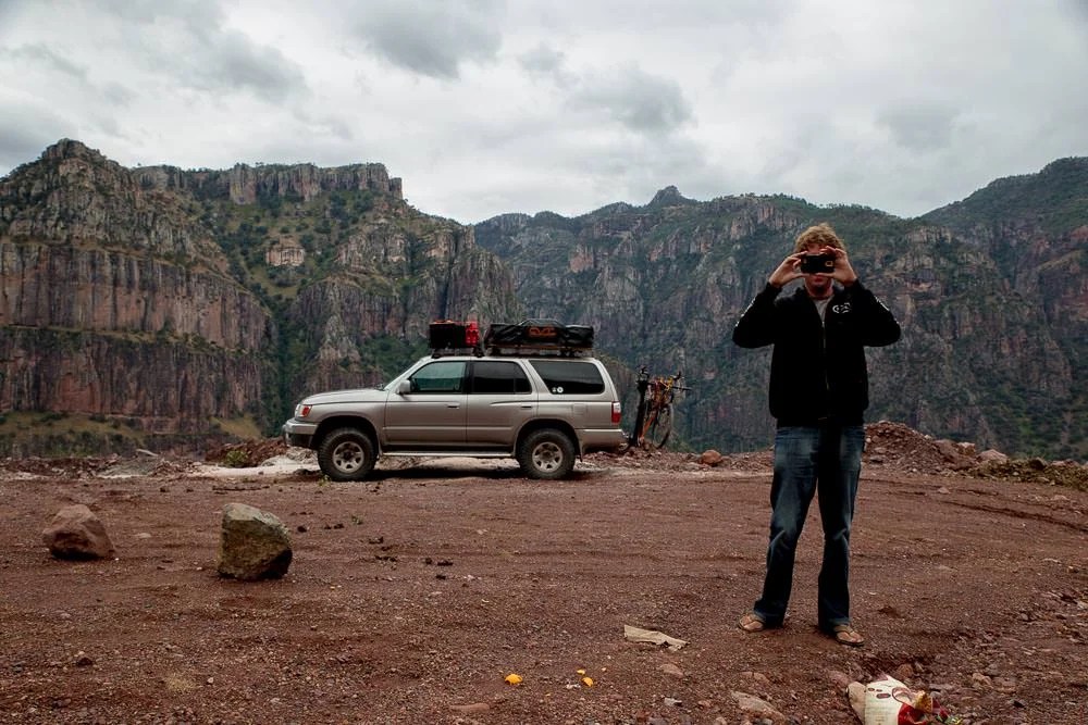
Also, it provided some great opportunities to take some more photos:


Eventually we ran out of paved road.
But from there it wasn’t far to the town of Batopilas.

Arriving in Batopilas in daylight was much more straightforward than arriving in Urique after dark. There appeared to be no official camping options, but there was a great little hotel that we couldn’t resist.
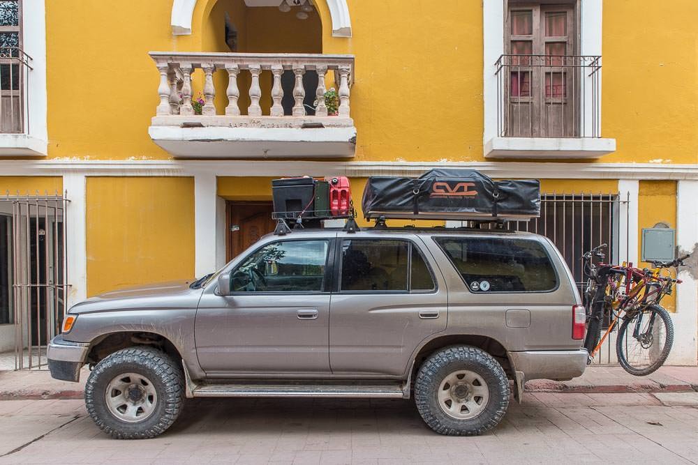
Juanita’s Hotel was nestled between the town’s main square and the Batopilas river.
Juanita herself was a delightful host, friendly and welcoming, it was like being invited into the house of a long-lost relative. Albeit one who only spoke Spanish. She was very patient with our stumbling attempts at Spanish and spoke slowly and clearly to make us feel like we were doing well at the language. She also made sure we had the perfect parking spot right outside her hotel.
We settled in to our room. It wasn’t long before we heard a gentle tap-tap on the door. Juanita apologetically asked if she could come in citing “algo peligroso” as the reason for her intrusion. What was this ‘dangerous something’ in the room? Exposed electrical cables? A giant tarantula? A small explosive device?
Intrigued, we watched as Juanita shuffled over to the bedside cabinet and opened the drawer. In the place where many hotels keep a bible, this sweet little lady retrieved six .45 rounds from an ashtray. Thanks Juanita. We won’t ask any questions.
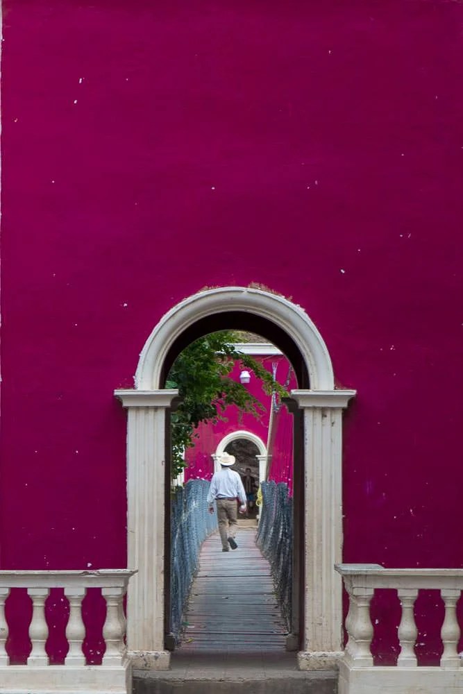
The town itself had a peaceful but slightly wild ‘frontier town’ feel.


Although the town’s peaceful slumber gave way to a hive of activity during parts of the day. The exterior of most buildings in the town centre appeared to be under renovation. We assumed this was in preparation for the probable influx of tour groups that were bound to follow the completion of the paved road from Creel.
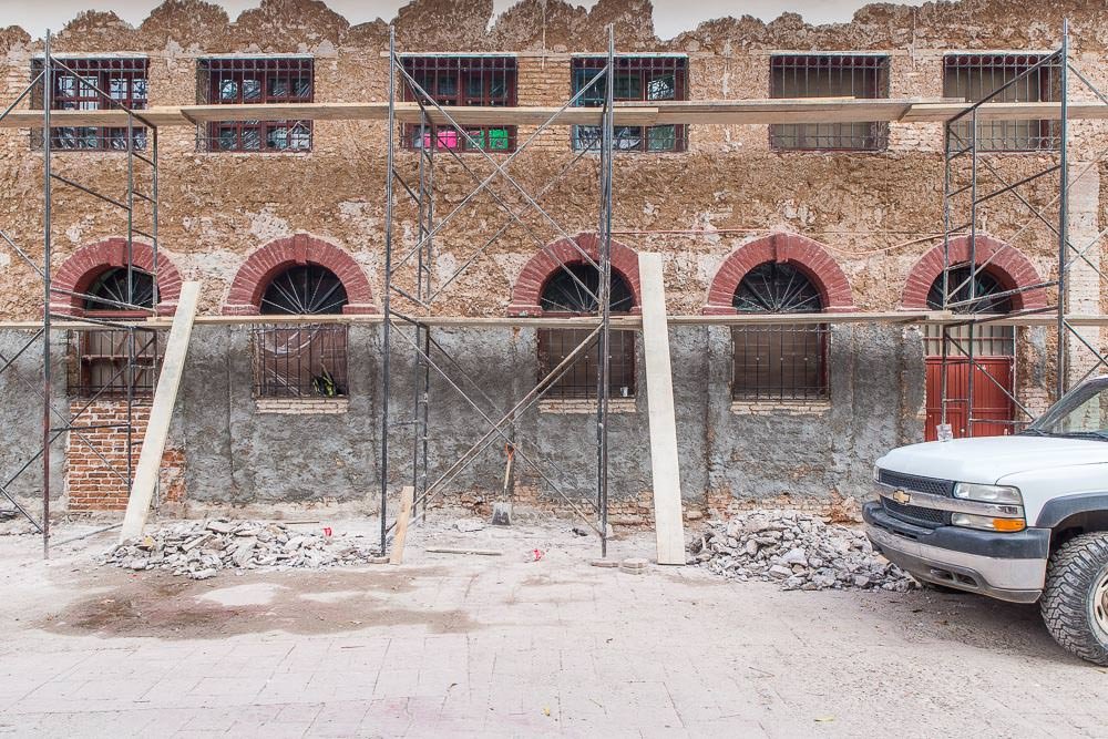
The town is one of Mexico’s Pueblos Magicos (Magic Towns). With the abundance of historically significant buildings and location at the bottom of such a spectacular canyon it was easy to see why it had made this list.
When we had arrived in Creel, we had seen a motorbike with UK plates and briefly spoken to one of its owners, with plans to find them again later and learn more about their travels. We had failed miserably at this, so were pleased when we arrived at Juanita’s Hotel and saw the same motorbike parked in the courtyard.
We followed the sound of voices and finally met Janette and Steve (www.tiger800rtw.com). They too were slowly making their way south from Prudhoe Bay in Alaska to Ushuaia, Argentina. We agreed to meet up for some beers and dinner that evening.
What we hadn’t factored in was how loud Mexico likes its music. Despite being a tiny bar (two tables) in a tiny town (population 1200) the bar was blasting music like it was providing the audio for a stadium show. In between songs we managed to glean a few nuggets of information.
Janette and Steve had started their travels at about the same time as us. We had only been a couple of weeks apart when we drove to Deadhorse and we had come close to crossing paths several times since. (Or perhaps it was ‘seven limes mince’, not sure, the music was impressively loud).
The local restaurant options were a little quieter. So quiet in fact that it was simply a table set up in the front room of someone’s house. The four of us sat and yarned about our experiences packing up our lives, selling our stuff, camping, travelling, exploring, the benefits of having a car, the bonuses of travelling by bike. Before we knew it, the hour was late and the people whose living room we were crashing were strategically turning off the lights one-by-one. Luckily, probably the only other two tourists in town at that time walked in and ordered a late night meal, making us feel a lot better about an evening imposing on the family’s hospitality for a little too long.

Janette and Steve were planning on heading back to Creel. This sounded like a sensible plan, but we were determined to find a road back to El Fuerte, despite our lack of maps. It hadn’t stopped us so far, so why would it now? Besides, we were doing so from the relative comfort and safety of our Four Wheeled Ticket to Freedom. What could possibly go wrong?
We asked Juanita about which roads to take. Which was a bold move, given how little Spanish we spoke. Luckily here directions were brief, clear and simple. No need to find the rough road rumoured to lead to Urique, no need to go to Tubares, to Mina El Sauzal, there was indeed another more direct road. She gave us directions as far as the small town of San Ignacio en route. From there she said, it would be best if we stopped and asked for further directions.
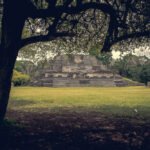
Emboldened by the simplicity of Juanita’s directions, we started the next day with a detour to a nearby Satevo Mission.
Because apparently, we hadn’t already seen enough churches.
It was a worthy detour. The novel exterior was interesting on its own, but some local teens we happy to retrieve the key to allow us a look at the dusty interior in exchange for a fair donation.
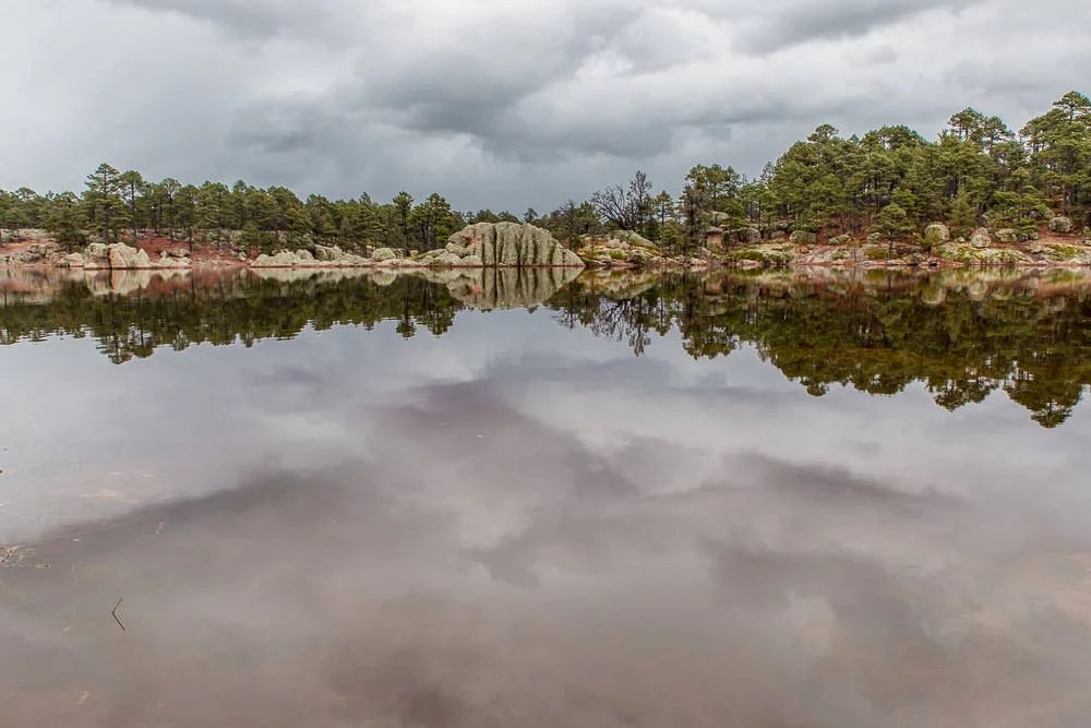
Also, the short drive along the river to the mission was no less scenic than any other journey in the Copper Canyon region. Sure, the mountains weren’t as rugged in this part of the canyon, but we weren’t complaining with views like these.

From there, we struck out towards the village of San Ignacio, following Juanita’s instruction.
Shortly after we left town we drove through what seemed like rather an extreme military checkpoint. About 30 or more heavily armed soldiers were just milling about. But this was Mexico, where convoys of armed police and soldiers are to be expected in many places, so we didn’t think too much of it.
Initially as Ben was attempting to respond to the questions of one soldier out the driver’s window. Emma was a little unnerved as a large man in full military get up, balaclava and assault rifle included walked menacingly towards the passenger window. But ever the diplomat, the tense situation was diffused by a smile and a wave. Rather than embarking on any complex lines of questioning in Spanish, the confused soldier politely smiled and waved back and shook his head, probably wondering if he needed to work on looking more menacing. Trust us, you don’t, you’ve got that one sorted. We just make up for our lack of Spanish skills by smiling and waving a lot…
Despite a few moments where we wondered if we were indeed heading the right way—we did arrive, as promised, in the village without making any wrong turns.

Arriving at this canyon bottom town in the heat of the day, there didn’t appear to be anybody around. The town was very quiet. Rather than actually putting any effort into finding someone to ask for directions, we took the obvious—but slightly ridiculous—option of just following the most well travelled road out of town in the vague direction of El Fuerte.
The road wound its way along the canyon bottom, through ranches and small settlements, crossing river beds and hugging hillsides, it mostly seemed to be heading in the right direction.
Yet again Javier (Our GPS) was adamant that there were no navigable roads in the area, but we could see the dot that marked El Fuerte and it looked like we were heading towards it.
Until we weren’t.
The canyon took a turn away from where we wanted to be heading. But the sheer canyon walls and imposing mountains seemed like a good reason for a deviation in the road, so we stuck with it.
For a while.
Then it really seemed like it wasn’t heading where we wanted to go.
We drove a little more, just to be sure, because, for some reason it seemed like the obvious thing to do.
Eventually we had to admit defeat, we began the slow backtrack to the village of San Ignacio to actually ask for directions. We had travelled for a quite some time down the wrong road. This return meant that we would be camping in the canyon that night, or driving after dark. There was to be no luxurious hotel room in El Fuerte at this rate.
It was with great excitement that we spotted some people milling around a parked truck in the middle of the road—excellent.
“Shall we ask these men for directions?” Emma bubbled excitedly.
“…Ummm what’s all that green stuff on the back of their truck.” Responded Ben, who let’s face it, is the more observant of the two of us.
They were, it turns out, a group of armed ‘farmers’ escorting a truck load of ‘produce’ out of the valley.
The Copper Canyon is famous not only for spectacular scenery, but as a particularly productive marijuana and opium growing region.
Filled with an immediate sense of dread it was clear we were in over our heads. Here we were, on a dusty back road, far from civilization (and only a vague concept of where said civilization was), face to face with a group of armed individuals who clearly chose to interpret the law more liberally than most.
There are no photos to accompany this section of the story. At this point we’d like to say ‘taking photos was the last thing on our mind’. But it wasn’t, we did wonder if we could, but decided it would be a suitably poor choice.
There was no other option, the armed ‘farmers’ had already seen us, we had been going the wrong way, so driving off and pretending we hadn’t seen their truck load of leafy green produce was not really a viable option.
Luckily by this point the leader of the group had started to wave us past, making it clear that there was enough space for us to move around their vehicle without any difficulty.
Well, might as well stop and ask for directions then.
The ‘farmers’ it turned out, had stopped for a relaxing break. We got a pretty long-winded answer to our question as to which way we needed to go to get to El Fuerte, but we gleaned the key information. It was down the road a short distance, left at the gates, through the river, straight up the hill …and then a bunch of other stuff. (This is where a firmer grasp on Spanish may have helped, or he might have been talking about something else by then.)
Either way, we gladly squeezed past the helpful ‘farmers’ and followed the directions.
When he had said through the river and straight up the hill, he had meant it. The narrow track appeared to go straight up the side of the hill, it had some unfathomably steep sections. Combined with the over-grown trees and rough state of the road, it was clear we were no longer on the main road to anywhere.

From the hill top, we decided we had had enough of being lost. Every time we saw any person we’d stop, check we were heading the right way and carry on.
Luckily this plan worked perfectly, as along this stretch of road there were just enough small villages to provide a steady supply of locals with a better sense of direction than us. Although everyone we spoke to initially looked at us like we were from another planet, they were all more than happy to provide either further directions or confirmation that we were headed in the right direction.

Following the advice of actual locals we found our way onto better roads:

Which turned into even better roads:

And eventually brought us out of the humid climate of the canyon bottom and back to the pine forest of the canyon rim:

Which again provided us with spectacular birds-eye views of the rugged Sierra Madre extending as far as the eye could see.

After winding our way around a narrow ridge line we said goodbye to the Copper Canyon and made our decent back to El Fuerte.
It was with much relief that we made a turn onto a dirt road and recognised that we had joined the road we had taken a few days earlier. We were only a few minute’s drive from paved roads—and it was still light—just.
Our bumbling mapless adventure through the Copper Canyon had been a success.
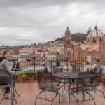
The sun finally set shortly before we arrived in to El Fuerte, but unlike Urique, they town was awake, open, full of street vendors and open shops. Even better, we knew where we would be staying, we drove straight back to the hotel we had visited earlier, it was time for a hot shower and a cup of tea.
We pulled up outside the hotel and were pleased that they had a room available for us.
The hotel’s owner wanted to know how our travels had gone in the Copper Canyon. Were we safe? Had we had any troubles? Seen any military? Seen any banditos?
We’ll yeah, we guess we saw a few of those, but no, no trouble. We didn’t meet a single unkind soul in our entire trip through the Copper Canyon. So many people had been polite and helpful. Even people we didn’t expect to be. So no, no troubles.

Everyone was standing around to hear our answers. Why all this interest?
Well, as it happens, shortly after we had driven through Urique and Cerocahui there had been a gang shootout in the area. Six people had been killed. The whole region was on high alert, tensions were rising.
That explained the armed group meeting in Bahuichivo. That explained the military presence just out of Batopilas.
The strange looks we’d been getting probably didn’t require any special circumstances to explain.
The people at the hotel said how lucky we’d been to avoid any trouble, especially driving the back roads without a map.
Yes, we were lucky. Lucky to be able to enjoy the region for its natural beauty, lucky to have been treated so kindly by all the people we had met. Lucky that for us a visit to the Copper Canyon was all good fun. A holiday and and adventure, where we got to avoid the tough realities of life in the area. We had caught glimpses of the gritty reality of some people’s lives in the canyon, of the affects of the drug industry in the area, of the sheer remoteness of some of the villages and the challenges posed by the unforgiving landscape. But we hadn’t faced any real adversity or strife in our travels, we got lost a bit, camped in the cold on the canyon rim, in the muggy heat of the canyon bottom, we learnt a bit more Spanish and took a lot of photos.
But maybe it was time to invest in a map…


3 Comments
What an amazing story and a great final chapter with an epic ending! Well worth the trilogy.
[…] but Steve and Janette (Tiger 800 Round the World). Who we had very briefly met months earlier in Batopilas in the Copper Canyon. They were equally surprised to see us, it seemed that all the other travellers we had all met […]
[…] but Steve and Janette (Tiger 800 Round the World). Who we had very briefly met months earlier in Batopilas in the Copper Canyon. They were equally surprised to see us, it seemed that all the other travellers we had all met […]